Friday Finds: Scottish Maps

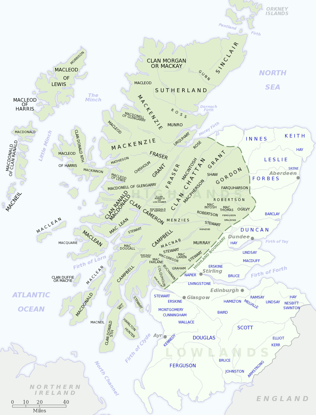
One of the joys of browsing other genealogy blogs—besides getting ideas on how to organize information, which always intrigues the designer in me—is finding new goodies to help my research. So, hat’s off to Kathleen Moore for finding and posting two helpful maps of Scotland in her blog “The Misadventures of a Genealogist”.
The first is a map showing the locations of the various Scottish clans. The only surname I recognize from my family is Buchanan, shown just to the north of the Highland border line, northwest of Glasgow. My Buchanans seemed to have been miners and were located in Shotts in Lanarkshire.
The second map shows the administrative subdivisions in Scotland. The majority of my Scottish ancestors lived in Lothian (East, West & Mid), Lanarkshire, and parts of the Scottish Borders.
Cite This Page:
Kris Hocker, "Friday Finds: Scottish Maps," A Pennsylvania Dutch Genealogy, the genealogy & family research site of Kris Hocker, modified 17 Sep 2010 (https://www.krishocker.com/friday-finds-scottish-maps/ : accessed 26 Apr 2025).
Content copyright © 2010 Kris Hocker. Please do not copy without prior permission, attribution, and link back to this page.


